Finding potential drinking water along hiking trails using Openstreetmap and Overpass Turbo
Date: December 2, 2023
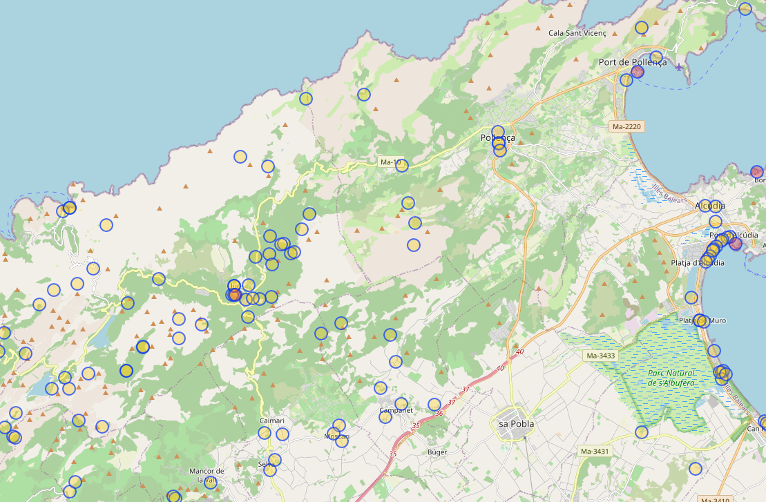
Overpass Turbo and Openstreetmap are incredibly useful tools for finding potential water sources along hiking trails. How?
-
Open https://overpass-turbo.eu/
-
Add follwing code snipped.
[out:json][timeout:25];
// gather results
(
  nwr["amenity"="drinking_water"]();
  nwr["amenity"="grave_yard"]();
  nwr["amenity"="shower"]();
  nwr["natural"="spring"]();
  nwr["tourism"="camp_site"]();
  nwr["drinking_water"="yes"]();
);
// print results
out body;
>;
out skel qt;
Beware: It’s not listing “common” sources like supermarkets and Cafes/restaurants.
- Move the map on the right to the region you want to supermarkets
- Execute ‘Run’